I recommend QGIS (formerly “Quantum GIS”) to enough people that it is useful to post my standard instructions. There is an official QGIS download page, but it is short on guidance where there are choices to make…
Mac OS
…except for Mac. If you are using a Mac, just download the binary from KyngChaos. Make sure to install any packages listed under “Requirements” first. As of Jan 2014, the installation protocol is:
- Install the following frameworks (available at http://www.kyngchaos.com/software/frameworks)
- FreeType framework
- GDAL 1.11 (or latest version) Complete
- This combines several important packages with GDAL, including GEOS and PROJ
- Install the following Python Modules (available at http://www.kyngchaos.com/software/python)
- NumPy
- Matplotlib
- Install QGIS (available at http://www.kyngchaos.com/software/qgis)
The particular installation instructions may change as QGIS develops, and William Kyngesburye does a good job of keeping the downloads current, so please check out the links and assume that anything on KyngChaos supersedes anything I’ve written here.
Windows
For Windows your choice is between the “official” QGIS install and the OSGeo4W (Open Source Geo for Windows) installer. I would recommend using OSGeo4W. It comes with a variety of open source geospatial software, which you can pick and choose, or just use the Desktop Express Install (which will install the most recent version of QGIS). The installer follows the Linux model in that the software are tightly integrated with their dependencies, so you will get recent versions of GDAL/OGR, GEOS, and PROJ, three libraries that undergird the entire open source geospatial ecology.
Linux
I’m only familiar with Ubuntu-based distros, so for other distros consult these instructions. For Ubuntu, the instructions at that link are unnecessarily ecumenical. There is no reason not to use the ubuntugis-unstable PPA, which, in spite of its name, is quite stable, and as far as I can tell is what everyone is using. For ease of reference, I repeat the instructions here. In the terminal:
sudo apt-get install python-software-properties
sudo add-apt-repository ppa:ubuntugis/ubuntugis-unstable
sudo apt-get update
sudo apt-get install qgis python-qgis qgis-plugin-grass
Any OS: OSGeo-Live DVD
Another option if you want a full operating system loaded with geospatial software is the OSGeo-Live DVD. This is a Lubuntu-based operating system that you can run in a virtual machine (I recommend VirtualBox). OSGeo-Live 8.5 has has a recent version of QGIS built in, but it is also linked to the ubuntugis-unstable PPA, so when you run software updates it will upgrade you to the most recent version.
Tutorials
For people new to QGIS, there are many helpful resources online, but two noteworthy sites are hosted at Baruch and Harvard:
I have used the Baruch one with my students in the past, and it is very good. It is almost a mini-textbook in GIS, with a lot of supporting text that explains the what and why of what you are doing in the software. The Harvard one I only recently became aware of. It is more point-and-click with less explanation, but it also has YouTube videos of each of the lessons.
Plugins
One of the reasons QGIS is such an amazing software is because of the rich ecology of third-party plugins. Strong plugins which become widely used eventually find their way into the core application, further contributing to the pace of development.
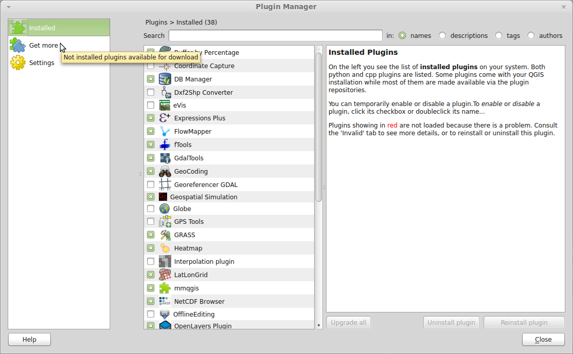
Plugins are installed and enabled by the Plugin Manager (Plugins→Manage and Install Plugins…). Plugins which are already installed are not available for use until you check the box in the list of installed plugins (see screenshot). Then they are added to the QGIS menus and toolbars. Some plugins will appear in their own top level menus, some will appear in another top level menu (e.g. Vector or Raster), and some will just appear as a new menu item in the Plugins menu itself. You may have to hunt around. To install new plugins, just click on Get New in the left pane of the Plugin Manager. Click a plugin name to see a (usually overly brief) description in the right pane, and click the Install plugin button in the lower right to install.
Here are some plugins that I think are worth installing immediately:
- Heatmap: A common way to visualize event (point) data
- MMQGIS: A useful collection of plugins by Micheal Minn. Duplicates some built-in functionality, but some of the useful functions include animation, creating grid layers (including hex grids), and geocoding using either the Google API or street centerline files (like Census TIGER/Line).
- QuickMapServices: This plugin lets you add a Google Maps, OpenStreetMap, and other open layers to your map. The Stamen layers are particularly attractive. Note that these layers force you to work in Web Mercator (EPSG:3857).
- QSpatialLite: A plugin for managing and querying SpatiaLite databases. Much, much better than the built-in DB Manager plugin. (Currently being updated for QGIS 2.0, should be released any day now.)
- Quick Finder: A plugin which allows quick attibute query in a docked window. Without this plugin you have to open the attribute table and use the query tools there.
- Spatial Query: Select features in one layer based on spatial relationship with features in another layer (contains, within, intersects, touches, etc.).
- XYTools: Read and write Excel and Open Document Spreadsheet formats. Good for joining attribute data delivered to you in Excel spreadsheets.
- Zonal Statistics: A common raster operation.

This entry is licensed under a Creative Commons Attribution-NonCommercial-ShareAlike 4.0 International license.